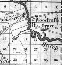
Download Woodruffs-Grove-map-Orange-Risdon.png
Information about "Woodruffs-Grove-map-Orange-Risdon.png" on Woodruff's Grove
Nearby LocalWiki regions:
Ypsilanti
Ypsilanti
Canton, MI
Wyandotte and Greater Downriver
Dearborn and Dearborn Heights
Jackson, MI
LocalWiki is a grassroots effort to collect, share and open the world’s local knowledge. We are a 501(c)3 non-profit organization.


Except where otherwise noted, this content is licensed under a Creative Commons Attribution License. See Copyrights.