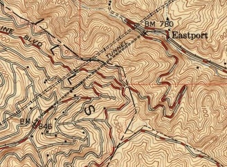
 Excerpt from 1949 Oakland East 7.5-minute Quadrangle topo map (in public domain, from UC Berkeley’s Historic Topographic Maps of California – San Francisco Bay Area)
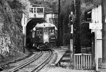
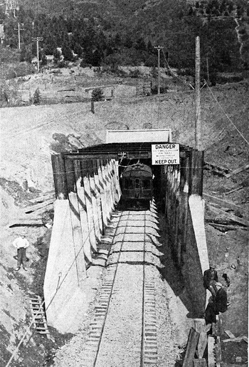
The 3700-foot long Redwood Peak Tunnel (c.1910–1957) was a railroad tunnel used by the Sacramento Northern Railway (SNR) to go under the Oakland Hills between upper Montclair (SNR’s Havens Station) and its Eastport station in Contra Costa County. The tunnel’s west portal emerged near the intersection of Saroni Drive and Shepherd Canyon Road (then part of Park Boulevard), and its east portal was adjacent to Pinehurst Road outside Canyon.
The tunnel was dug 1910–13 by the Oakland and Antioch Railway (OAR), predecessor to the Oakland, Antioch and Eastern Railway, which later merged with the SNR. The work was done by contracting company E. B. and A. L. Stone Company, run by Egbert B. Stone and his brother.
Last used in 1957, the tunnel has since been sealed at both ends. In 1982, a house built over its Oakland side was destroyed when the tunnel below it caved in. Itʼs worth reading the court opinion that ended the litigation over this home’s destruction, if only for the history of the original easement. Note the references to the Mahogany Eucalyptus and Land Company and People’s Water Company. Also note that the plaintiff in the case bought the property from Caltrans, who had purchased it as part of the right-of-way for the proposed Highway 77 (aka the “Park Boulevard Freeway”—details on the Unbuilt Oakland page).
 East Portal near Eastport Station 1
  West Portal 3
Links and References
- Sacramento Northern at Daniel Levy’s OB&E website
- Platts v. Sacramento Northern Ry. (1988)
- Oakland History Group on Facebook May 3, 2022 [looking for original source material]


